Not For Profit Map for Donation Unit Management
Managing your donation units can be a difficult and time-consuming activity. Make it safer and simpler for yourself and your staff with NFP Map.
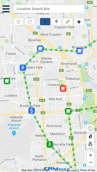
NFP Map uses clear color and icons to quickly identify which units need attention. Your staff can easily plan their routes and have it automatically pushed through to Google Maps for voice-based navigation. Once collected just one button click from their phone lets your collectors update your system from anywhere.
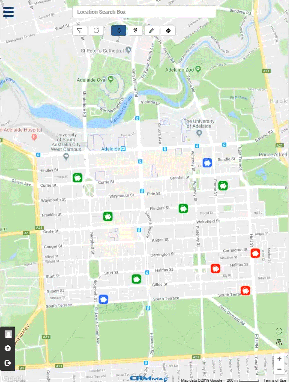
This page uses the example organisation ‘The BlueBox Foundation’ which uses a variety of donation unit types to help the needy. They use different icons to distinguish between their food, clothes, and coin units. Colors are used to determine whether a system is still operating, in need of a collection, or cancelled.
Please try as their administrator who can modify which collectors have access to the system, what terminology they use, and what types of units or data they collect.
Try a collector who simply sees what they need to collect and update the system as they reach each location. Alternatively scroll down to the embedded version of the map that ‘BlueBox’ has on their website.
NFP Map uses clear color and icons to quickly identify which units need attention. Your staff can easily plan their routes and have it automatically pushed through to Google Maps for voice-based navigation. Once collected just one button click from their phone lets your collectors update your system from anywhere.
This page uses the example organisation ‘The BlueBox Foundation’ which uses a variety of donation unit types to help the needy. They use different icons to distinguish between their food, clothes, and coin units. Colors are used to determine whether a system is still operating, in need of a collection, or cancelled.
Please try as their administrator who can modify which collectors have access to the system, what terminology they use, and what types of units or data they collect.
Try a collector who simply sees what they need to collect and update the system as they reach each location. Alternatively scroll down to the embedded version of the map that ‘BlueBox’ has on their website.
Utilize your resources for strategical coin collection
Eliminate messy spreadsheets, have instant alerts to when units need collecting or replacement with on the fly data of their fund’s status. Have instant data on which districts or businesses are collecting the most revenue towards your fundraising. Don’t waste time in areas that aren’t going to provide a return in investment. Utilize this live feedback to best decide where to put your resources and get the return your NFP needs.
Promote a public map of where people can make donations
NFP Map lets you freely embed a version of your map into your website. Use it to let your donors know where they can make donations. Also support those who support you by linking to their website increasing both of your websites’ SEOs.
Try Me Out